I took Wednesday off work and went out to Snoqualmie Pass with a friend to attempt my most ambitious climb yet. Putrid Pete’s Peak (PPP or 3P) – named for legendary mountaineer and K2 hero Pete Schoening. I’m not sure why they added the “putrid” part, except perhaps that the ascent is a murderous climber’s trail. This was a super fun, extremely challenging, hike/scramble.
The trail rises from the Ira Spring trailhead, which most people use to climb Mt. Defiance or see the westernmost of the Alpine Lakes – Lake Mason, Rainbow Lake, Island Lake, etc. But shortly beyond the trailhead, where the main trail switches back toward Mt. Defiance/Bandera/Apline Lakes, there’s a small oft-neglected trail that leads north toward PPP.
The trail is fairly nicely maintained (though not nearly as wide and smooth as the Mt. Defiance trail) for about a mile and a half, loamy and generally pleasant in secondary growth forest. It rises gently for a while, and then shifts to some gnarly, muddy switchbacks for a bit, before finally breaking through the treeline and into open “meadow” – if you can call a heavily-bouldered 40% grade a “meadow”.
From there, the switchbacks cut out and it becomes a climber’s trail straight up. This was tough work for me. Strength-wise I was good but the CV load was very challenging with my current condition. It’s taking me a long time to regain my fitness, but I’ll get there. Mt. Rainier gradually starts emerging from over the ridges to the south (which include Mt. Washington, McClellan Butte, and Change Peak, among others.).
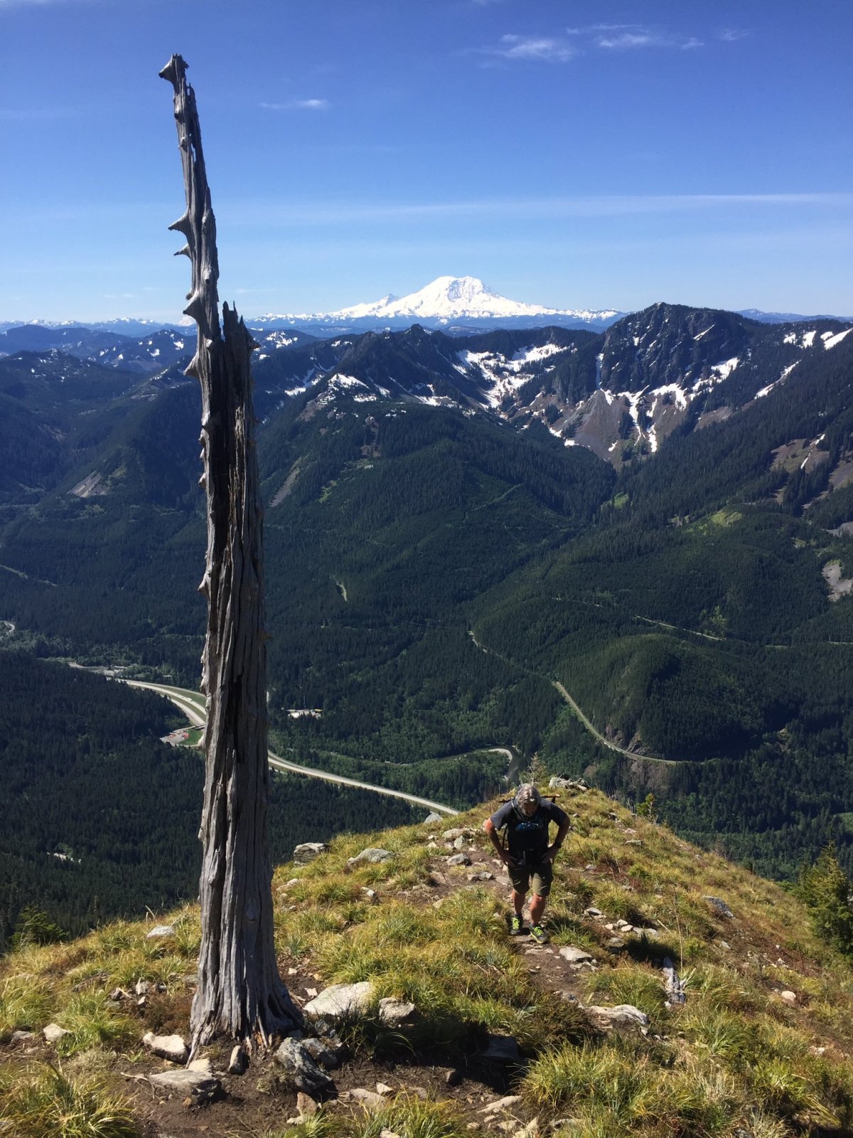
This long climb – 3000′ over 2.5 miles – finally reaches PPP, which is really just a bump on a long ridge between Mt. Defiance and Web Mountain. As you gain the ridge, you can look down into Spider Basin. The ridge is a true knife-edge ridge. The side you come up is about a 40% grade, and the other side is a nearly-sheer drop at least 500 feet, maybe a thousand, down to the snow and boulder-fields that lead to Spider Lake.

Spider Basin is a gorgeous wilderness area, which is only visible after at least a 2000′ climb up one of the trails from the I90 corridor. I’d love to go camping in there some time but this would not be the route to take to get there!
After reaching the top of PPP, we traversed the quarter mile or so over to Web Mountain, along the knife-edge ridge, acutely aware of snow cornices and possible rockfall. It’s a treacherous route, at least for someone of my skills. My climbing partner, Aaron from work, was more comfortable scrambling. But it was fun, and there was some real bouldering involved to get over there (click to embiggen):


I really enjoyed the scramble even though it was a challenge. Though I’m pleasantly sore today, not beat to hell. Though I did stumble a few times and I have an impressive array of strawberried scrapes to show off. The view from Web was substantially similar to PPP, but the entire horizon was just amazing.

And as usual, Mt. Rainier stood over everything in stunning fashion.
The route down was also a challenge and a lot of my scrapes were earned then. I’m glad I had a trekking pole, though Aaron didn’t and was just fine. All in all it was about six and a half miles, 3100 feet of gain, and a great day in the National Forest.
