The last week of December was a deep cutback week in our training plan, although we did an 8-mile trail race Sunday (recap to come). But the weekend before Christmas was our biggest yet, with 23-24 miles total split between 13-14 on Saturday and about 10 on Sunday. (The ranges are reflective of some variations in our GPS tracks and calculations.)
We headed out to Tiger Mountain, planning to do a route we’d found on AllTrails. But the route we’d picked started at a weird spot—no official trailheads we could spot, no clear parking aside from a big space off the side of the road, and access required trekking along a stretch signed “Private Road”. So we headed back down the interstate to a clear trailhead with a lot of cars, deciding we’d do an out and back run. With the Garmin fēnix 5/5S, the “trail run” activity automatically includes a screen with the trace you’re running, and the watch has a “Back to Start” navigation option to keep you on track.
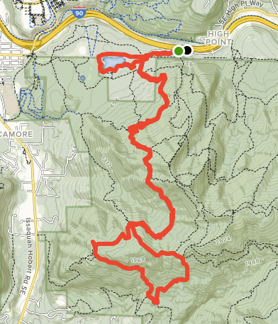
 We parked off SE 79th St in Issaquah. The Cable Line trail starts here—we did not take it, because even though it’s marked on the trail maps, there’s a sign essentially discouraging use. We instead followed a little connector trail through the woods to the High Point Way Trailhead.
From there, we started up West Tiger 3 Trail, a wide path with a steady climb (15% grade range, so a hike for us).
We then kept right on Talus Rocks Trail, where the hill continues briefly before sort of leveling out. Talus Rocks is a single track dirt trail, with some short, steep drop downs. The trail is a bit hard to track immediately at times, and we unwittingly ended up off trail for a brief detour around some boulders. December has been characteristically wet so there were some tranquil runoff falls along the trail.

Where Talus Rocks intersects Section Line Trail, we took a sharp left to head up the mountain. And we spotted the sign that let us know we were in for an adventure.
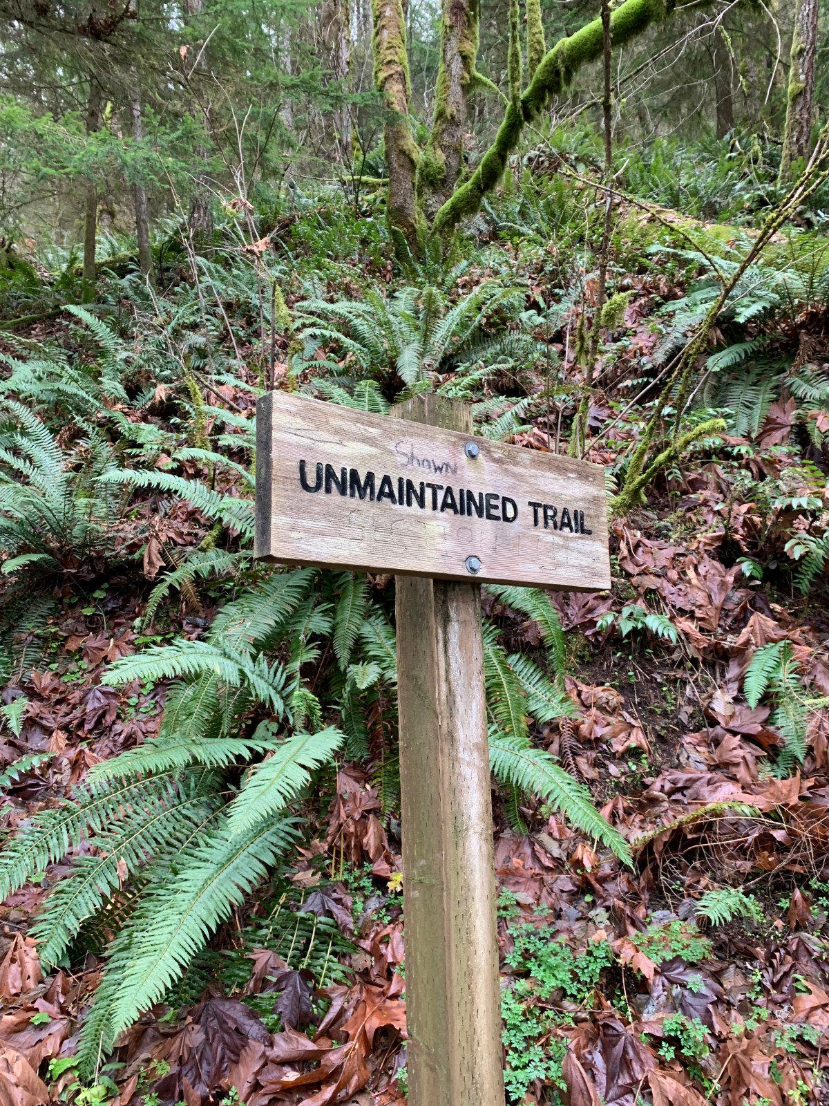
It’s not too hard to follow the path (if it can be called such) through the woods, and it’s only about 3/4 of a mile long. It takes time though, because it is steep—the average grade works out to about 30%. Or as Gene put it…
Once we reached the top, we had a choice: keep heading up to the summit or have a reprieve. We took the latter option, turning right onto West Tiger Railroad Grade. This section of trail, as you might guess, is pretty flat, so we could actually run for a bit. It’s easy to follow here, the width of the trail varying from easily two wide to narrow foot placement. Watch out for the occasional old cable looping up out of the trail.
 After a couple of miles of pretty flat running, we came to a 4-way intersection. We took a quick break and consulted the AllTrails map. We noticed there was a nice little loop that would bring us back to this intersection. We took a left to head up One View Trail then just turned/kept right each time we had an option.
Eventually this brought us around to a logging road (Tiger Mountain is a working forest, with revenues supporting public services). The views open up, and had it been a clear day, we’d have had a nice shot of Rainier. But there was a thick, low ceiling of cloud, so we could just make out the base instead.
Continuing along the loop, we passed close to Poo Poo Point and detoured to take in the sweeping views from there. We’ve previously visited this vista, which is also busy as a paragliding jump point during the summer—not so much on an overcast December day.

We closed the loop, then traced our way back to Tradition Plateau via West Tiger Railroad Grade, Section Line, Talus Rocks, and West Tiger 3 Trails. We were pretty beat, but I wanted to get another mile in, so we took the flat trail around a small lake before returning to the car. All together, we ended up with 13-ish miles (maybe a bit more) and over 3000 ft of elevation gain for the day—some excellent training for our upcoming 50K.