Continued from Setting the challenge. (50 Miles, Part 1)
Before Wy’east Wonder was canceled, I clocked in some big (for me) training weeks. My coach threw in a little downtime to recover after the cancellation (early May), followed by an easy build block and a slight taper before the big day.

The route
Tiger Claw was set up as a short flat warmup, followed by 3 loops on the mountain—3 ways up (color coded Pink, White, and Yellow) and 1 way down (Blue). The inaugural event, which Gene and I did in 2019, clocked in around 23 miles. Ethan & Kim had planned changes for the flat warmup and one of the routes up the mountain this year, which would bring the course to just about 25 miles. They hadn’t updated the GPX files or map, but they had posted a description of the new mountain route. Using AllTrails, I had mapped the route as best I could so I could train on the course.
Typically the distance and vert calculations differ between methods. I know that AllTrails tends to underestimate distance a smidge. I pay a “trail tax” on my GPS watch based on wheel measured courses, about 5-7% under on distance and a small amount on elevation gain. But on a solo event, the GPS watch is the option I have. Since I did training runs on the course, I had a good sense of distance and vert measures.
| Route | Est. distance (mi) | Est. vertical gain (ft) |
| Green (flat loop) | 1.7 | 50 |
| Yellow | 5.8 | 3000 |
| Pink (new, my mapping) | 5 | 2800 |
| White | 2.9 | 2200 |
| Blue (down route) | 3 | 75 (& 2200 loss) |
The blue route is the single way down, so I’d do this 3 times per Tiger Claw. Using the new pink loop routing (and going with the original green loop), I estimated the course at 24.4 miles and 8300 ft of gain. That would bring me up just shy of 50 miles, but I figured I could tack on an out-and-back along a service road from the trailhead to top off the distance.
Tiger Mountain has a lot of crisscrossing trails. If you’re going for a set route, you need to know it well or have some guidance. I run with Garmin fēnix, which allows you to load courses for navigating on the run. The maps that Garmin uses in its Connect app haven’t been great for trails in my experience—not particularly accurate and often missing trails in systems. So I instead:
- Map courses out in AllTrails
- Download the GPX file from AllTrails
- Upload the GPX file to Garmin Connect
- Upload the course to the watch from Garmin Connect
I think it’s simpler than it sounds 😅
The fēnix navigation buzzes as you approach and reach a turn, popping up a direction indicator arrow. On winding trails, the buzzing can be a bit excessive, but it does a pretty good job of keeping me on track. I upgraded from the 5S to the 6S Sapphire this spring, and the course is layered over preloaded topo maps. This is very handy when you encounter multiple intersecting trails, as you will on Tiger Mountain!
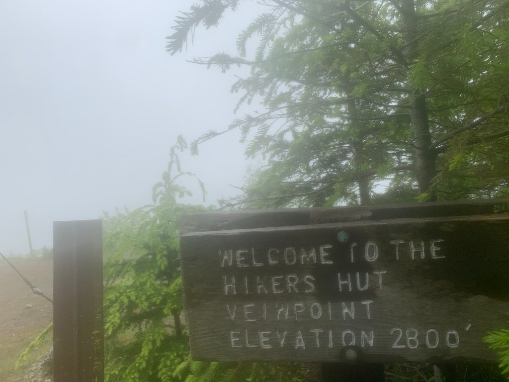
I was able to put in a few training runs on Tiger Mountain. When trails reopened, I was glad to find much of the Tiger Claw course was lightly trafficked, even on Sunday mornings (though morning runs meant that there wasn’t time for the fog to clear).
The supplies
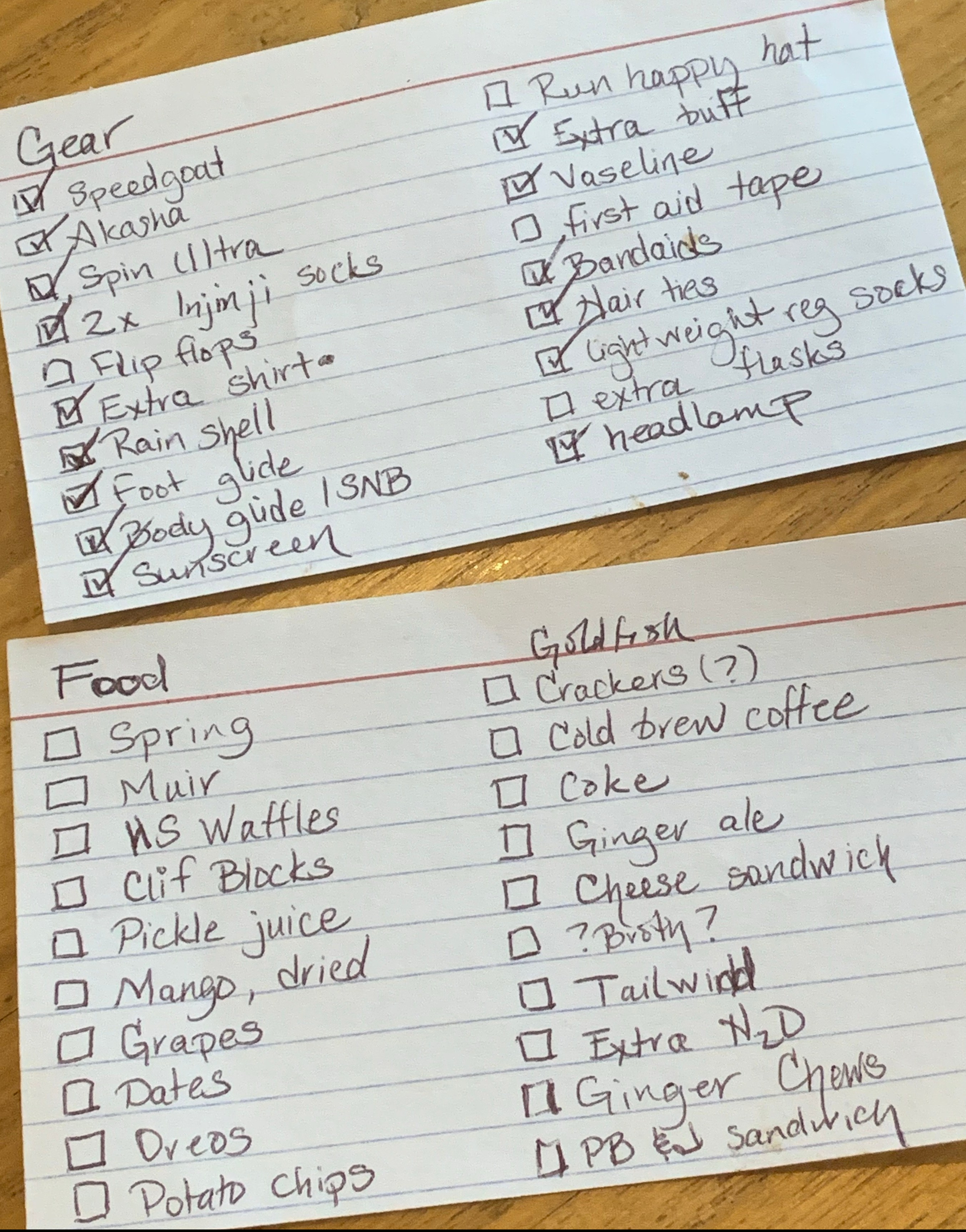
A few days before the attempt, I wrote out checklists for food and gear. Gene looked them over, and I reviewed in my head—and a good thing too, because I realized I’d forgotten to add headlamp!
The food list included everything that I’d want to carry and to have at the ‘aid station’ (aka car). I stopped by Seven Hills to be sure I was stocked with on-the-run fuel and pick up an extra soft flask for my vest. Gene did the aid station shopping and prepped sandwiches the night before.
After a load of laundry, I pulled out the clothes I thought I’d want to wear. The weather was looking promising—starting off in the mid to upper 50s, partly cloudy, and warming up to about 70 and sunny. I went with:
- GRGR Rabbit tee – so soft! I knew a tee might be warm later in the day but I also wanted to minimize chafing risk
- Oiselle long Roga shorts – Good length, lightweight material, and loose legs so I wouldn’t have to worry about things feeling restrictive or riding up
- Under Armour Pure Stretch thong – I’ve had for ages. Simple and prevents chafing for me.
- Brooks Dare Strappy bra – This is my new favorite running bra. All day comfort, good fit, also not restrictive
- Brooks Dash arm warmers – I tend to run a little cool at the start of a run and have come to embrace arm warmers as a fast, convenient way to adjust on the run.
- Injinji trail sock – Socks are determined in part by shoes, and I was planning to start with the Scarpa Spin Ultra, which I wear with Injinji (aka toe socks). The trail version have a medium cushion and low crew cuff, which keeps gunk from working its way into the sock.
- I Support Local Race Directors head wrap/neck gaiter – Because we are living in plague times and I take my contribution to community health seriously, I pulled one of my wraps to have for when I encountered others on the trail. I acquired this one as part of a fundraiser that Coast Mountain Trail Running set up for local race directors in North America.
The one thing I couldn’t find was my favorite Run Happy cap. I grabbed a couple of other options and didn’t fret much, knowing I’d likely drop the hat as the temps warmed.
I gathered and organized the gear. An advantage of an independent 50-mile experience: I didn’t have to think about a drop bag. I just tossed what I wanted into a bin or bag (sorted so I’d know where to find what). I remembered to grab my Aftershokz Aeropex headphones (Bluetooth connection and leaving my ears open to hear ambient noise) and sunglasses.
Finally I prepped my vest. Since I’d have the chance to refill every 2-3 hours, I just carried 2×500 ml soft flasks and an assortment of on-the-run fuel. For a bit of race day spirit, I decorated the GRGR bib. I came across my original Tiger Claw bib, and it seemed fitting to add it to the mix too.

An early start
I knew that 50 miles on Tiger Mountain would take every ounce of daylight there was. Gene loaded much of the gear and non-perishable food in the car the night before. We set a 4 am alarm. Coffee. Toast and nut butter for the road. Refrigerated things into the cooler. Load up and roll out. The sky was already getting light. We got to the Highpoint Trailhead right on schedule, 5 am. I popped the Discovery park pass on the mirror. I was as ready as I could be for a loooooong day ahead.
To be continued…

[…] Logistics: Prepping for ‘race’ day. (50 Miles, Part 2) […]
LikeLike
[…] Yet I felt surprisingly at ease as I set out under rapidly brightening skies at 5:10 am on Friday, July 10, 2020. I had trained to build strength. I had tapered to have fresh legs. I had a dependable crew (Gene) waiting for me at the end of each loop. I had planned and prepared… […]
LikeLike